- Interact
3D Room Experience
Gain a complete understanding of the space, even without a prior visit. Our features provide you with all the clarity you need.
TRUSTED BY
TRUSTED BY
- 3D Room Experience
Experience Spaces in 3D. Anytime, Anywhere.
Comprehend the space entirely, even if you’ve never set foot in it. The scan path, textures, snapshots, detailed dimensions and north heading offer all the clarity you need.

Scan Path
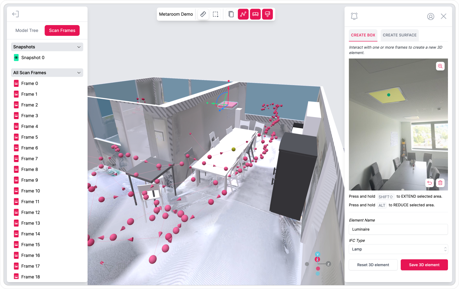
Don’t worry about missing any details during the scanning process. Metaroom Workspace shows automatically captured Scan Frames with precise location that can be viewed anytime, anywhere.
Textures
Your scanned room is automatically captured with textured surface that you can show or hide in the 3D model. From the type of flooring to the color of walls, Metaroom Workspace makes it easy to recognize and reference small details.

Snapshots
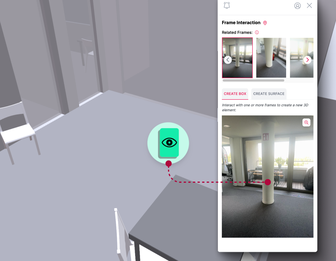
Effortlessly review your manually captured Snapshots within the 3D model. The precise location of each Snapshot is clearly marked, making it easy to understand where each photo was taken within the space.
Measuring
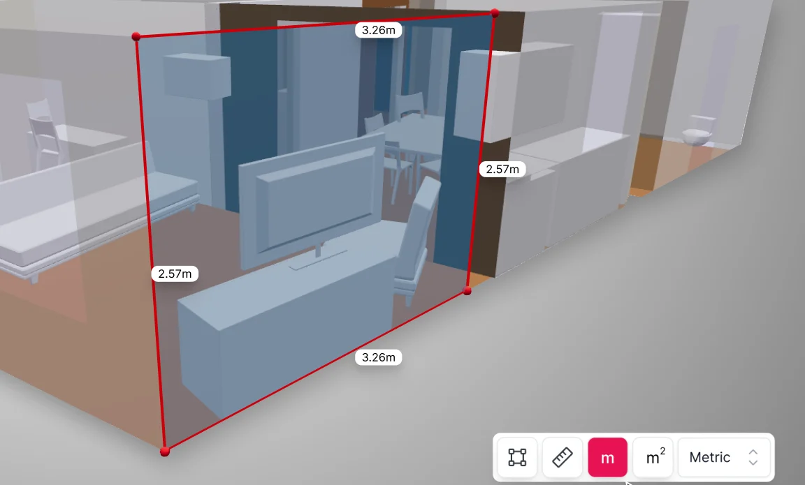
Measure the room elements of your scanned space whenever necessary. Whether you’re checking specific dimensions or measuring distance, Metaroom’s measurement toolbox is here to assist you.
North Heading & GPS location
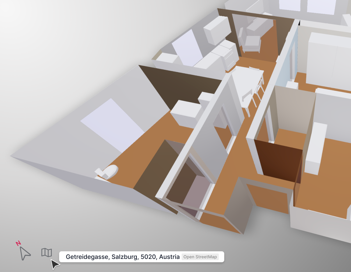
Boost the accuracy of your 3D room models with north orientation and geographical location data for your scanned spaces. This ensures detailed planning and greater efficiency in your project workflows.
- Capabilities
2D or 3D? The Choice is Yours.
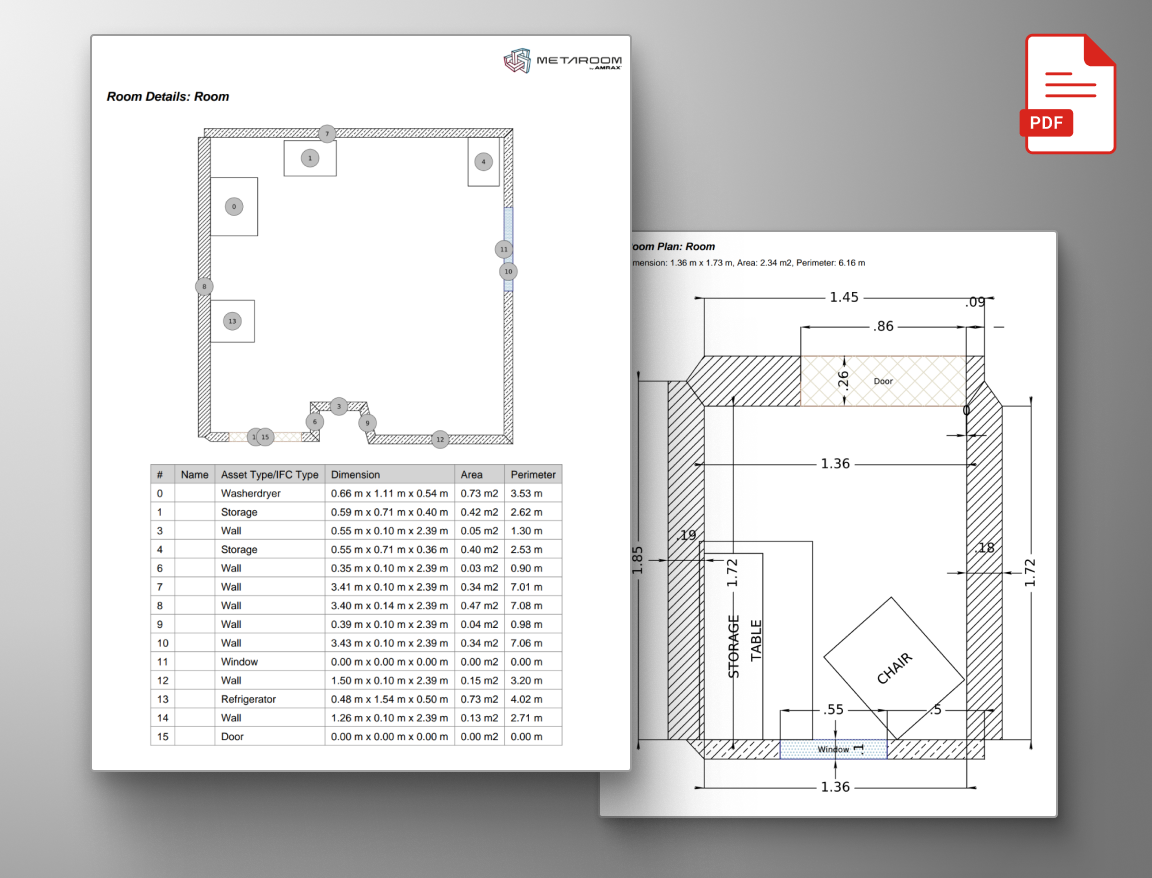
2D Floor Plans & Reports
Get your scanned space with detailed measurements as a 2D Project Report, conveniently available in PDF format.
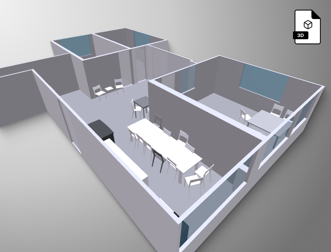
3D Room Models
Export your scanned space as a 3D model in various formats, complete with detailed room measurements.
- MORE USE CASES
Explore Metaroom Workspace for spatial planning
The complete toolset to immerse yourself in interactive and precise 3D modelling.
3D object creation
Create additional 3D objects in your model with just a few clicks with Metaroom's AI-assisted instance segmentation.
- Learn more
Detailed measurement
Whether you’re checking specific dimensions or measuring distance, Metaroom’s measurement toolbox is here to assist you.
- Learn more
Project documentation
Document your space with a single scan. Review and specify your 3D room model anytime, with all room data preserved and ready for future updates.
- Learn more
3D model specification
Customize your 3D models with detailed information for seamless integration and tailor them perfectly to your needs.
- Learn more
“Metaroom® has revolutionized my workflow by significantly reducing
the time I spend on measurements, compared to traditional laser methods.
Its intuitive design simplifies my work process, freeing up valuable time for more critical tasks.”
Marc Mörgeli
|
Lighting Consultant & Project Manager
More time-efficient
compared to conventional spatial planning methods
Return on investment
with our optimized planning experience and saved resources
Created 3D models
with true to size measurements and successful project outcomes
- Testimonials
Why professionals choose Metaroom
Markus Hegi
CEO @ Relux Informatik AG
“This partnership has the potential to revolutionize the way external field staff interact with its customers. The partnership between AMRAX® and RELUX is an important step in the development of design and construction technologies.”
James Cook
Industry and technology partnerships
“Embedding Metaroom’s 3D models within Autodesk Construction Cloud helps teams understand the real-life context of the Issues, RFIs, Submittals and more that they track in Autodesk Construction Cloud, helping them make better-informed decisions.”
Georg Emprechtinger
CEO @ Team 7
Digitalization is an important trend that influences and changes our lives and economies every day. In the furniture industry, we need to drive automation and digitalization in order to remain efficient and competitive in the long term.
Frequently Asked Questions
Does Metaroom have a free trial?
In what units can I measure a 3D model?
You can easily switch between metric (meters) and imperial (feet) measurement systems when measuring your scanned room in the Metaroom Workspace.
How to review Snapshots in a 3D Room Model?
Within the 3D model in the Metaroom Workspace, you’ll see distinctive green markers. These represent the Snapshots you captured during your scan, providing quick access to key areas.
How to display the Scan Path in a 3D model?
When you open your scanned project in the Metaroom Workspace, the navigation bar at the top includes the “Show Scan Path” icon. Clicking it will reveal your scanning movements, represented by dots. The darkest dot shows the starting point, while the lighter dots indicate the end of your scan.
Is North Heading and GPS location always shown within the 3D Room Model?
To capture GPS location data, you need to enable GPS while scanning with the Metaroom Scan App. Keep in mind that accuracy of North Headings can be affected by electromagnetic interference. Inserting a SIM card into your Apple Pro device may help improve location accuracy. However, the feature remains functional even without a SIM card.


