How Laser Scanning is Revolutionizing the Way We See the World
Have you ever thought about what it would be like to have superhuman powers that let you see through objects and create a 3D map of your surroundings? Well, with the advent of LiDAR technology, that power is now at our fingertips.
Shedding Light on the Magic of LiDAR: How LiDAR Sensors Create 3D Maps of Our World
LiDAR (Light Detection and Ranging) is a technology that uses light to measure distance and create accurate 3D maps of the environment. It works by emitting laser pulses that bounce off objects in the environment and measuring the time it takes for those pulses to be reflected back to determine the distance and shape of the object.
Imagine, you are standing in a dark room with a flashlight. If you shine the flashlight on an object, the light reflects off the object and bounces back to your eyes. The time it takes for the light to bounce back gives you an idea of how far away the object is. In fact, the concept of using the time it takes for a signal to bounce back to determine the distance of an object is also known as “time-of-flight” and is used in various sensing technologies, including acoustics. When we hear thunder, for example, we are essentially hearing the sound waves that were generated by lightning and then bounced off nearby objects before reaching our ears. By measuring the time, it takes for the sound to travel from a lightning strike to our ears, we can estimate the distance of the storm. Similarly, LiDAR technology leverages time-of-flight to measure the distance of objects. It does so by emitting laser pulses and measuring the time it takes for the light to bounce back to a sensor, allowing for precise distance calculations. LiDAR sensors create a precise 3D map of the surroundings by emitting thousands of laser pulses per second. The LiDAR sensors can also establish the distance to multiple points on an object, generating a 3D depth map of the object’s shape.
How LiDAR is Revolutionizing Robotics, Archaeology, and Autonomous Driving
Initially, LiDAR was used for military purposes, such as targeting and guidance systems for missiles and bombs. Later on, it was used in environmental and atmospheric research to study the Earth’s surface and the atmosphere, including measuring the thickness of ice sheets, mapping forest canopies, and studying atmospheric aerosols. Nowadays, LiDAR has found its way into a variety of other fields, such as robotics, archaeology, and even entertainment. Let’s delve into some ways LiDAR is changing the way we understand space.
Robotics
Robotic vacuum cleaners, or Roombas, use LiDAR sensors to navigate around a room and avoid obstacles. By sending out laser pulses and creating a 3D map of the room, the Roomba can efficiently clean every part of the space while avoiding furniture and drop-offs.
Archaeology
LiDAR technology has been used to uncover ancient ruins and lost cities hidden beneath dense foliage. By flying LiDAR-equipped drones over areas of interest, researchers can create detailed 3D maps of the terrain that reveal features that are invisible from the ground. This technology has already uncovered previously unknown sites in Cambodia, Guatemala, and Honduras, and it’s sure to lead to even more exciting discoveries in the future.
Autonomous Driving
Mounted on the roof or bumper of our autonomous vehicles, these sensors provide critical information that helps our vehicles “see” and understand the world around them. LiDAR data is combined with other sensor data, such as cameras and radar, to create a complete and accurate picture of the environment. Our advanced algorithms and machine learning techniques analyze this data in real time, enabling our autonomous vehicles to make intelligent decisions about how to navigate through the environment. LiDAR is especially useful in low-light or poor weather conditions, where traditional camera-based systems may struggle to detect objects accurately.
From Laser Measuring to LiDAR: The Most Efficient Way to 3D Room Reconstruction
LiDAR technology is changing how we understand space and revolutionizing various industries, from robotics to autonomous driving. However, its impact isn’t just limited to these fields. In fact, LiDAR is also transforming the way we reconstruct rooms.
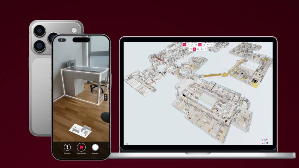
Metaroom® uses a combination of LiDAR and RGB sensors in smartphones to achieve optimum geometric accuracy for room reconstruction. The system uses state-of-the-art deep learning technology. This includes an accurate and robust room geometry estimation process combined with deep learning-based instance segmentation to detect relevant objects. In order to enable the highest accuracy in reconstructions, Metaroom® utilizes both RGB and depth sensors, such as LiDAR. The depth sensor sends out laser pulses that bounce off objects in the environment and are reflected back to the sensor, which creates a 3D map of the room. RGB sensors capture the colors of the objects and textures of surfaces in the room, which can be used to identify and distinguish between different items. By using both types of sensors in combination with deep learning technology, Metaroom® can provide highly accurate textured and detailed reconstructions of rooms including assets such as furniture and light.
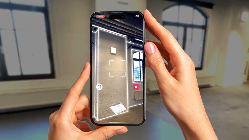
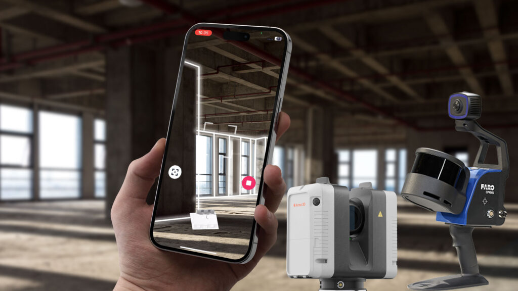
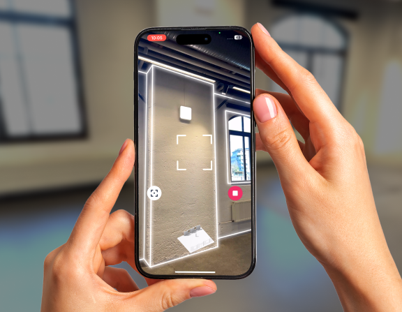
Compared to traditional methods such as single-point measuring and creating a model by hand, using LiDAR and RGB for room reconstruction has several advantages. First and foremost, it is much faster and more efficient, as the user can simply scan the room with a mobile device, which typically takes less than a minute. This eliminates the need for time-consuming and labor-intensive manual measurements or model building.
The level of detail in the reconstructed 3D model allows for more realistic and immersive visualization of the space, which can be particularly useful for lighting and interior design. Moreover, the use of deep learning technology in conjunction with LiDAR and RGB can also improve the accuracy of object detection and segmentation, making it easier to identify and extract relevant features in the room. This can help streamline the design and planning process, as well as provide personalized data.
Revolutionary Rumor Alert: iPhone 15 could Feature Sony’s Game-Changing LiDAR Sensor!
Are you eagerly anticipating the release of the iPhone 15 Pro? Well, hold onto your hats because the new Sony IMX611 ToF sensor might just revolutionize the LiDAR technology of this coveted device. Although Sony hasn’t mentioned any buyers for the IMX611, rumors suggest that the iPhone 15 Pro and Pro Max could be the first devices to use this new chip.
The new Sony IMX611 ToF sensor, with its highest efficiency in detecting photons, energy consumption, and distance measurement improvements, could revolutionize LiDAR technology for smartphones, especially for the upcoming iPhone 15 Pro and Pro Max. The Metaroom® App, which already uses a combination of LiDAR and RGB sensors to achieve optimum geometric accuracy for room reconstruction, could benefit from this new sensor’s ability to optimize autofocus in low-light conditions, capture three-dimensional spaces, and aid in augmented reality calculations. With a reliable error rate for distance measurement of less than 0.1%, the IMX611 could provide highly accurate and detailed reconstructions of rooms, making it an ideal choice for Metaroom’s® room geometry estimation process combined with deep learning-based instance segmentation to detect relevant objects of interest.
We’ll have to wait and see.