


Subscribe to our newsletter and get exclusive product and industry updates.
By subscribing you agree to our Privacy Policy.


USE CASES
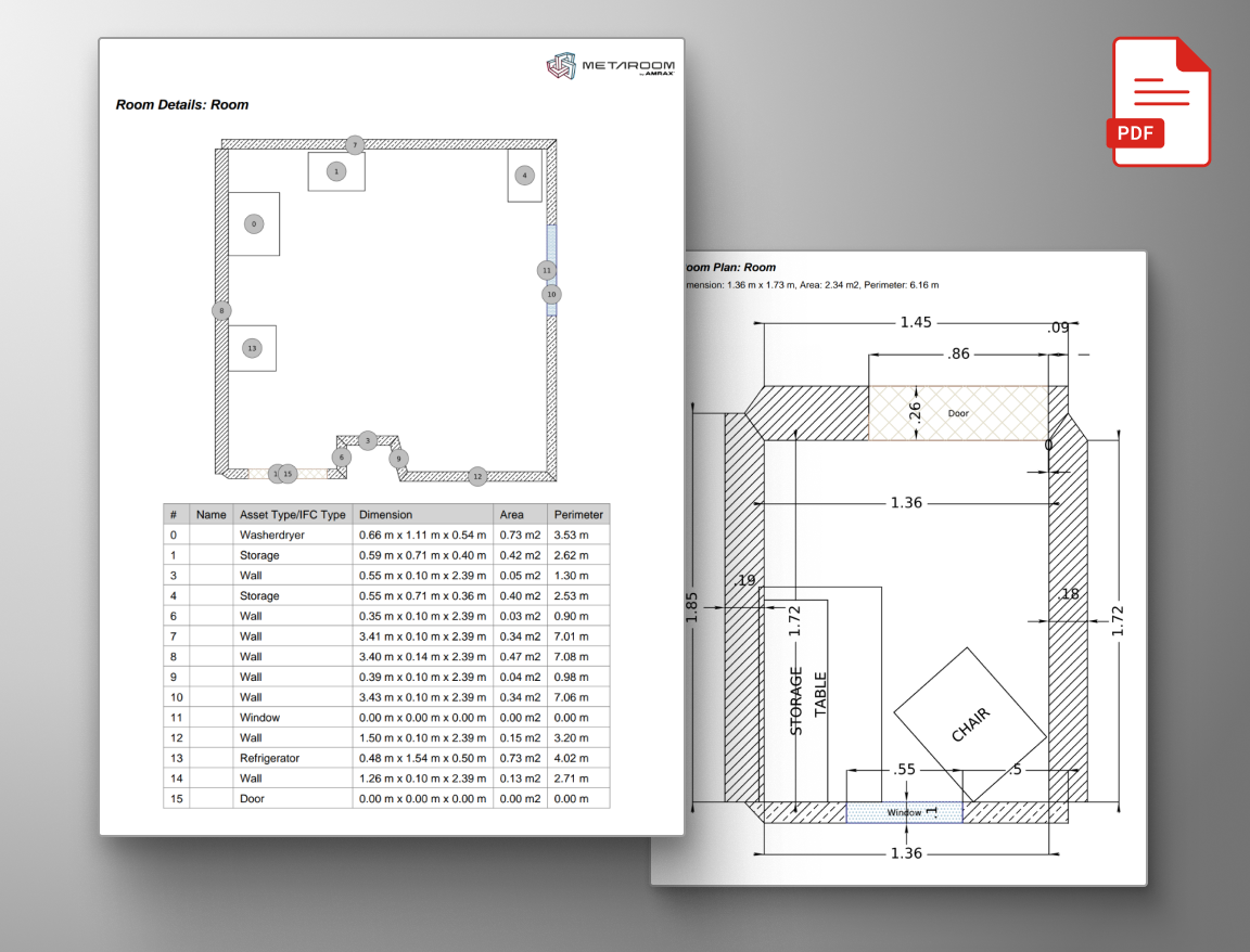
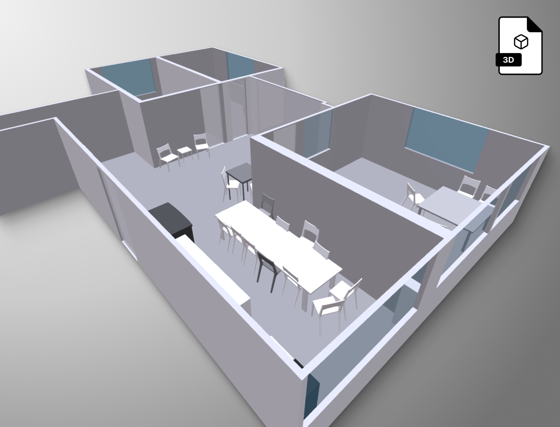
FORMATS & INTEGRATIONS
© 2026 AMRAX, All rights reserved.