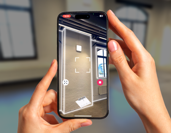
Efficiency and accuracy are key factors in any spatial planning project, and this holds especially true for industries relying on advanced technology like 3D scanning. At Metaroom®, we understand the importance of staying ahead of the curve and providing our users with cutting-edge tools to streamline their workflows. With the recent release of the North Heading and GPS Location features, we’re excited to delve deeper into the impact these enhancements can have on your scanning experience.
Navigating with Confidence: The North Heading Advantage
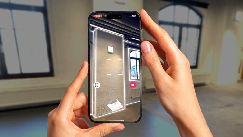
For professionals working in fields such as light planning or architecture, maintaining accurate orientation during scanning is essential for producing high-quality and user-oriented designs. In this regard, introducing the North Heading feature in Metaroom® represents a significant advancement. By providing planners with a clear indication of the 3D room model’s north heading, we empower spatial experts to navigate their scanning environments confidently and precisely.
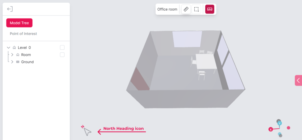
Imagine a scenario where a lighting planner is assigned the task of redesigning the lighting layout of a building. With Metaroom’s 3D scanning app, they can effortlessly capture the entire building in a detailed 3D model and seamlessly export it to Light Planning Software. What sets this process apart is the precise North Heading orientation encoded into the 3D model, ensuring accurate sun positioning for any time of the day. This streamlined workflow minimizes inconveniences in room exploitation and provides lighting planners with a reliable reference point for orientation. Whether they’re designing new rooms or documenting structural elements, having this level of accuracy significantly enhances the project’s overall efficiency.
Moreover, building owners are increasingly focused on lighting control to maximize energy savings. End-users also expect higher performance in light levels, color rendering, uniformity, and overall aesthetic appeal. That’s where North Heading information becomes crucial for light planners and facility managers as they can optimize lighting and enhance energy efficiency. With Metaroom, pursuing environmentally sustainable practices becomes more cost-effective!

Important: spatial planners should be mindful of potential sources of interference that may affect its accuracy, such as electromagnetic fields. An inserted SIM card in your Apple Pro device during the scan process might help alleviate these inaccuracies. However, the feature remains operational even without one.
Unlocking Location Intelligence: The Power of GPS
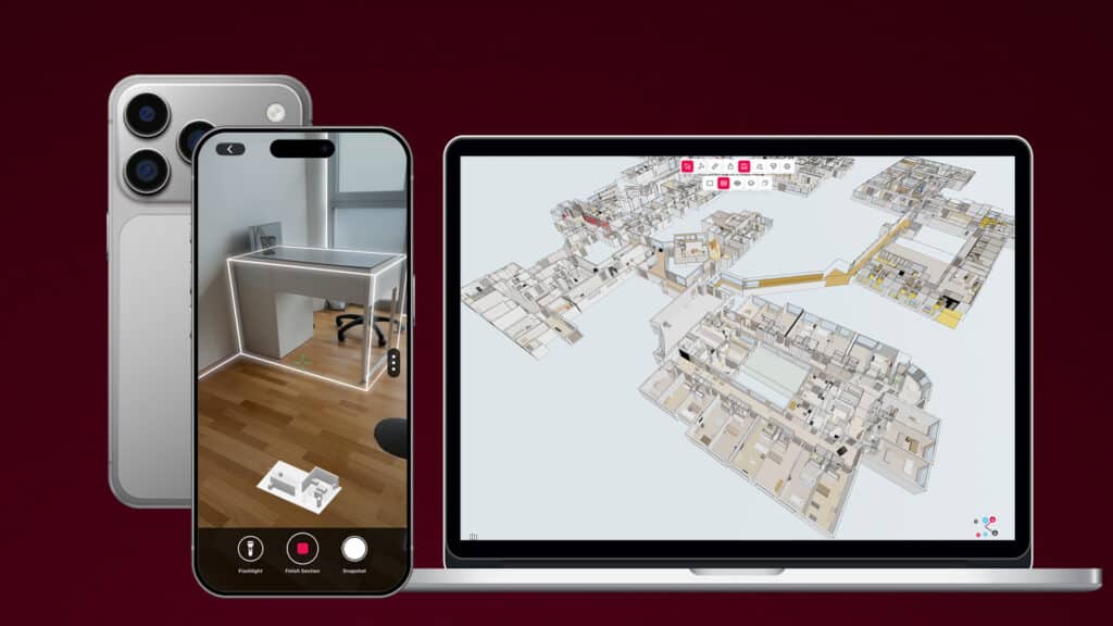
In addition to providing users with orientation data, Metaroom® now offers integrated GPS Location functionality, allowing users to access precise geographic coordinates for their scans. This feature opens up possibilities for professionals seeking to seamlessly incorporate spatial data into their projects.

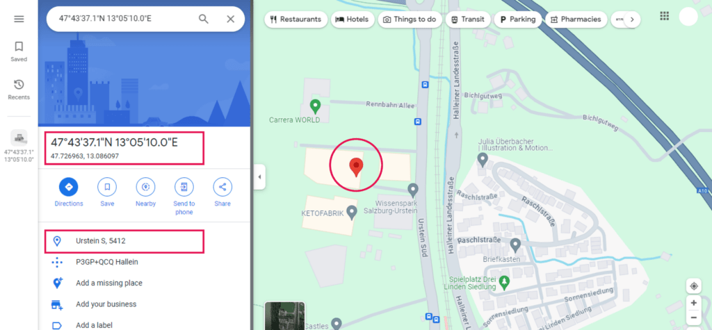
Picture a scenario where a BIM expert is entrusted with analyzing the layout of a recently scanned 3D building for an upcoming project. With GPS Location activated in Metaroom’s 3d app during the scan, they gain seamless access to precise geographic coordinates associated with the scan. This invaluable feature allows them to document essential building information accurately and provide valuable insights for decision-making processes.
Furthermore, accessing scan addresses and GPS positions directly from Metaroom® Studio adds a layer of convenience to the scanning process. Professionals can quickly reference location information and share it with colleagues or clients, facilitating team communication and collaboration.
The Full Potential of North Heading and GPS Location in 3D Models
In addition to revolutionizing how we approach 3D room modeling, the introduction of North Heading and GPS Location features in Metaroom® brings forth many advantages that enhance the overall scanning experience. Let’s delve into the comprehensive benefits these features offer:
Enhanced Information about 3D model: having a reliable north heading orientation reference helps spatial planners to calculate daylight more precisely. Meanwhile, GPS location guarantees precise geographic positioning of the scanned spaces, eliminating guesswork and enhancing the fidelity of the models.
Improved workflows: With clear orientation and GPS location data at your fingertips, you can streamline a project workflow and minimize design errors. With just a few clicks, spatial planners can retrieve essential location information, eliminating the need for manual data entry and external tools. This seamless integration saves time and effort, allowing experts to focus on the projects without unnecessary distractions.
Encoded data in export formats: North heading and GPS location data are included in supported export formats like RDF (Relux Desktop) and all IFC (2×3, 4, Ranplan, Palette CAD, SirkBIM, Autodesk Revit). This means that additional information regarding the scanned 3D room model is easily accessible within other software applications.
The North Heading and GPS Location features in Metaroom® offer a holistic approach to 3D room modeling, combining accuracy, efficiency, and convenience to deliver an unparalleled scanning experience. Whether you’re a lighting planner, architect, or BIM expert, these features empower you to unlock your projects’ full potential and quickly achieve superior results.
To Sum Up
At Metaroom®, we’re committed to driving innovation and pushing the boundaries of what’s possible in 3D scanning technology. The release of the North Heading and GPS Location features represents the latest step in our ongoing journey to empower users with powerful tools and capabilities.
As we continue to refine and enhance our solutions, we welcome feedback from our users to ensure we meet their evolving needs and expectations. The input from our 3D modeling community is invaluable to us, and it plays a crucial role in shaping the future direction of Metaroom®.
The introduction of the North Heading and GPS Location features marks a significant milestone in the evolution of Metaroom®. By providing our users with enhanced orientation and location data, we’re enabling them to unlock new possibilities and achieve more tremendous project success. We look forward to seeing the innovative ways our users leverage these features and exploring new avenues for collaboration and advancement together!