By Iryna Rotter-Lukashuk · Updated October 2026 · 9 min read
Short answer: On an active construction site, 3D laser scanning checks what was built against the plan, often to the millimetre. Which laser scanner fits depends on the job. A terrestrial scanner on a tripod gives the highest accuracy for checks such as floor flatness or the position of openings. A mobile scanner, which you carry while walking, covers large areas faster but is usually less precise. For an existing building, the usual job is an as-built floor plan or a BIM model for renovation. A LiDAR-equipped iPhone Pro or iPad Pro with a documentation app covers that at centimetre level, in minutes per room.
“3D building scanning” covers two different jobs. People use the same words for both, but the tools, tolerances and budgets are far apart.
On the construction site, a scan answers a control question. Is the slab flat enough? Are the openings where the BIM model says? How far has the work progressed this week?
In an existing building, a scan answers a planning question. What is actually there, how big are the rooms, and where are the walls, windows and installations? Architects, energy consultants, electricians and facility managers need that before they can plan.
Below, we explain both jobs, what each method delivers and what it costs. We build Metaroom, so our own product is in the comparison, including where it is the wrong choice.
What is 3D building scanning?
3D building scanning measures a building’s surfaces with a laser or LiDAR sensor and records them as millions of 3D points, called a point cloud. Software turns that data into a 3D model, a floor plan or a BIM model.
The workflow has three steps:
- Capture. A scanner on a tripod, a walking mobile scanner or a handheld device measures the space.
- Register and process. Software joins the individual scans into one dataset.
- Model and export. The data becomes the deliverable: a point cloud, a CAD drawing, an IFC model or a quantity list.
On the construction site: laser scanning for control
Laser scanning for construction is mostly quality control. The scan is compared with the design, and deviations are found before the next trade covers them.
Typical uses:
- As-built vs. as-planned. The point cloud is laid over the BIM model to check positions of walls, columns, openings and sleeves.
- Floor flatness. A 2026 study scanned a 450 m² floor during construction and evaluated it against the German flatness standard DIN 18202. Areas outside the limits were found and checked on site (Studnicka & Zurl, RIEGL, 2026).
- Progress monitoring. Repeated scans show what was built between two dates. Research at TU Munich found that scaffolding and formwork hide much of the structure, so automatic progress checks still need careful capture planning (Tuttas et al., TU München, 2014).
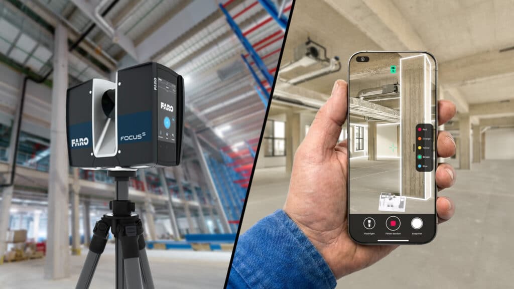
These jobs need millimetre-level data, large outdoor areas and long range. That is terrestrial laser scanner and mobile mapping territory: FARO Focus, Leica RTC360 or BLK360, Trimble X7, NavVis and similar.
Where a phone scan fits on site: late in the job, once interior rooms are closed. A room-by-room scan records the finished state for handover, for facility management or for the fit-out trades. It does not replace the surveyor’s control scan.
In existing buildings: 3D scanning for planning
In existing buildings, the scan serves planning. Renovation, energy retrofits, lighting and electrical planning, fire protection and facility management all start with the same question: what is here?
Often the plans are missing, outdated or never matched the building. The deliverable is a 2D floor plan, room areas and a BIM model of walls, doors and windows. Centimetre-level accuracy is enough; speed and a clean CAD export matter more.
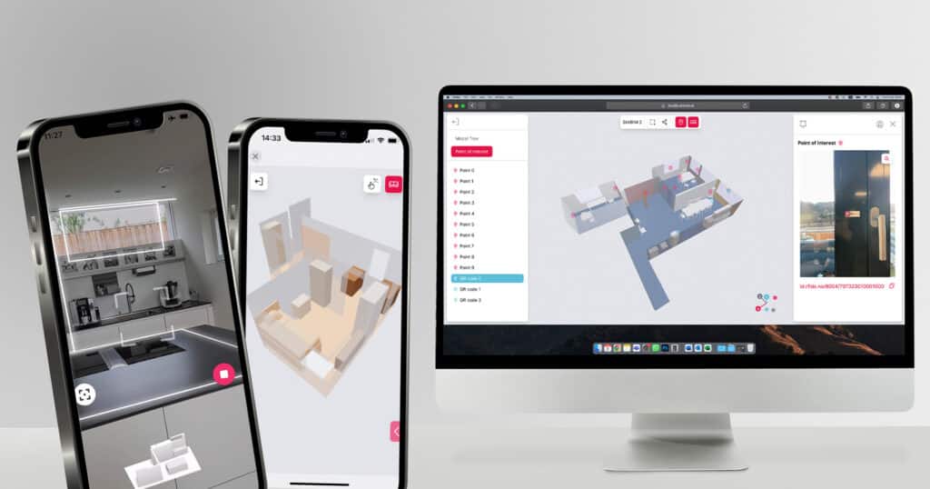
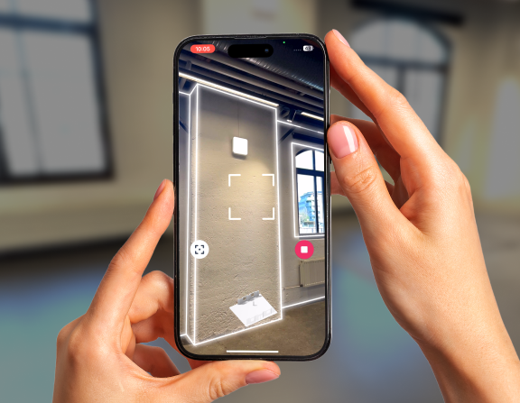
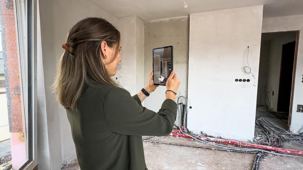
This is where phone-based LiDAR works well. An iPhone Pro or iPad Pro captures a room in minutes. With Metaroom, the scan becomes a 3D model and a 2D floor plan in a browser workspace, ready to export to the planning software you already use.
How accurate is 3D building scanning?
The method sets the accuracy. For context, the USIBD Level of Accuracy specification puts its LOA20 level at 15 mm to 5 cm (95% confidence), a common range for building documentation (NavVis, 2022).
Phone LiDAR has been tested against professional laser scanners:
- Single rooms and objects: around 1–1.5 cm RMSE. An iPad Pro reached ±1–1.5 cm against ±0.5 cm for a Leica terrestrial scanner (Kucak et al., Geomatik, 2023). An iPhone 13 Pro measured door and room dimensions within 0.4–1.8 cm mean error (Zaczek-Peplinska & Kowalska, FIG 2022).
- Larger spaces, free-form capture: errors grow. A 6 × 13 m classroom showed 4.2 cm distance RMSE (Yanchuk et al., Geodesy and Cartography, 2025). Corridor scans drifted 6–8 cm on average (Jeftha & Shoko, South African Journal of Science, 2024).
So phone LiDAR is not a survey instrument, and how you scan matters as much as the sensor. Metaroom scans room by room in sections, with a Tracking Assistant that warns when tracking becomes unstable. That keeps drift in check, and it is why we state accuracy as up to 99% at centimetre level, never millimetres.
3D scanning methods compared
| Method | Example devices | Stated accuracy | Hardware cost | Output | Best for |
|---|---|---|---|---|---|
| Terrestrial laser scanner | FARO Focus Premium, Leica BLK360 | FARO Focus Premium: up to 2 mm. Leica BLK360: 4 mm at 10 m | FARO Focus Premium 200M kit $65,610; Premium Max 400M kit $84,429. BLK360 $26,500 (US list) or €14,000 bundle incl. 1 year software (Europe) | Point cloud, then modelling | Site control, flatness, structural and survey work |
| Mobile mapping (SLAM) | FARO Orbis, NavVis VLX | FARO Orbis: 5 mm mobile, 2 mm stationary Flash scan | Quote only; no reliable official price published | Point cloud of large areas | Large sites, plants, multi-storey shells |
| Camera + LiDAR tripod | Matterport Pro3 | ±20 mm at 10 m | from $3,995 (device only) | Virtual tour; BIM files (LOD 200) ordered from Matterport | Tours, remote walkthroughs |
| Phone LiDAR + Metaroom | iPhone Pro, iPad Pro | up to 99% at cm level | Device you may already own + subscription | 3D model, 2D floor plan, IFC, DXF, Excel | Existing buildings, as-built plans, renovation |
Accuracy figures are the manufacturers’ stated values, not independent tests. Prices are dealer or list prices as of September 2026 and vary by region, package and included software; laser scanner software licences come on top. Sources: FARO Focus, Leica BLK360 and Matterport Pro3 prices and accuracy from 3D Mag, 3D laser scanner prices 2026 (updated 16 Sept 2026); FARO Orbis from Geo Week News (Oct 2023); Matterport BIM files from Matterport.
From scan to BIM: point cloud or model?
BIM laser scanning produces a point cloud: millions of measured points, but no walls, doors or rooms yet. Someone then models the building in Revit, ArchiCAD or similar. That modelling step adds time and cost after the scan. Our Top 11 3D Laser Scanners for Scan to BIM covers the hardware side.
Metaroom takes a different route for existing buildings. The cloud reconstruction turns the room scan into a structured model with walls, openings and objects. You export it to 40+ formats, including IFC, DXF, Excel quantities and formats for ArchiCAD, Revit, DIALux, RELUX, DDS-CAD and CASCADOS. Objects that are not recognised automatically can be added (AI-assisted) in the Metaroom Workspace.
Where Metaroom is the wrong choice: survey-grade tolerances, construction-site control scans, outdoor capture, very large industrial sites, and teams without a LiDAR-equipped Apple device.
Which method fits your job?
| Your deliverable | Tolerance you need | Practical choice |
|---|---|---|
| Deviation check against BIM, flatness, structural control on site | mm | Terrestrial laser scanner (buy, rent or hire a surveyor) |
| Progress capture of a large site or shell | mm to low cm, large area | Mobile mapping (FARO Orbis, NavVis or similar) |
| Virtual tour for marketing or remote walkthroughs | visual | Matterport |
| Floor plan, room areas, IFC/DXF model of an existing building | cm | iPhone Pro / iPad Pro with Metaroom |
| Handover documentation of finished interior rooms | cm | iPhone Pro / iPad Pro with Metaroom |
Many firms use both: a laser scanner or surveyor for the few control jobs, and phone scanning for the daily as-built work in existing buildings.
Frequently Asked Questions
What is 3D laser scanning in construction?
It is the capture of a building or site as a dense point cloud with a laser scanner. On construction sites it is used to compare what was built with the design, check floor flatness and document progress. The point cloud is then compared with, or modelled into, a BIM model.
How accurate is 3D building scanning?
It depends on the method. Terrestrial laser scanners reach millimetre level; FARO states up to 2 mm for the Focus Premium. Phone LiDAR reaches around 1–1.5 cm on single rooms in independent studies, with more drift on large areas scanned free-form. Centimetre level is enough for floor plans and planning models.
Can I 3D scan a building with an iPhone?
Yes, for interior as-built documentation. An iPhone Pro or iPad Pro has a LiDAR sensor with about 5 m range. Scan room by room, and an app like Metaroom builds the floor plan and BIM model. It is not suitable for survey-grade checks or outdoor capture.
How much does 3D building scanning cost?
A terrestrial laser scanner costs from about €14,000 (Leica BLK360 bundle with one year of software, Europe) to about $84,400 (FARO Focus Premium Max kit), plus software and modelling time. Dealer prices as of September 2026. Hiring a scanning service is quoted per project. Phone-based scanning uses a device you may already own and a monthly subscription.
What is BIM laser scanning?
It is laser scanning done to create or check a BIM model, often called Scan to BIM. The scanner delivers a point cloud, and a modeller builds walls, slabs and openings from it in Revit, ArchiCAD or similar. Phone-based tools such as Metaroom produce the model directly for existing buildings, without a separate modelling step.
Can I use phone scanning on an active construction site?
Only in finished interior rooms. Phone LiDAR is limited to about 5 m range and centimetre accuracy, so it does not replace control scans of structure, slabs or facades. It works well for handover documentation once rooms are closed.
Try it on your next as-built job
Scan one room with your iPhone Pro or iPad Pro. Open the floor plan in the browser. Export it to the software you already use.
Start a free 30-day trial of Metaroom – no credit card required. See plans and pricing