Last updated: October 22, 2026
The best 3D scanning platform depends on the job, not on the hardware. For construction QA/QC (Quality Assurance and Quality Control), OpenSpace (360° site capture with BIM overlay) and terrestrial laser scanners such as the Leica BLK360 lead. For facility management, Metaroom turns an iPhone or iPad Pro into a survey tool for floor plans, area lists and asset documentation without dedicated hardware, while Matterport and NavVis IVION suit portfolios that need a full digital twin. For restoration and insurance work, magicplan and DocuSketch export Xactimate ESX files. For real estate, Matterport and iGUIDE combine 3D tours with measured floor plans. For energy consulting, Metaroom and magicplan deliver floor plans and room data that feed energy and heat-loss software.
3D scanning platforms compared
Nine platforms, compared on type, capture hardware, best-fit use cases, outputs and pricing model.
| Platform | Type | Capture hardware | Best-fit use cases | Key outputs | Pricing model |
|---|---|---|---|---|---|
| Metaroom | iPhone/iPad LiDAR scanning app with web Workspace | iPhone 12 Pro or later, iPad Pro (2020 or later) | Facility management surveys and asset documentation, energy consulting, renovation, trades | 2D floor plans (PDF, DXF), IFC, Excel quantities, Snapshot photo export, GLB, OBJ | Free app; Workspace plans from €149 per year |
| Matterport | 360° digital twin and virtual tour platform | Matterport Pro3 camera (from $3,995) or supported smartphones | Real estate, facility management | Hosted 3D tour, floor plans, E57 point cloud and BIM file (add-ons) | Free tier, paid subscription, enterprise; camera bought separately |
| NavVis (MLX, VLX, IVION) | Mobile laser scanners plus web digital twin software | Handheld (MLX, CLX) and wearable (VLX 3, VLX 4) laser scanners | Facility management, construction verification, scan-to-BIM | Point clouds, 360° panoramas, IVION web twin, Revit add-in | Hardware purchase plus IVION subscription, quote-based |
| iGUIDE | 360° camera with built-in lidar for property measurement | iGUIDE PLANIX R1 camera | Real estate, smaller facility portfolios | 3D tour, ANSI Z765-2021 floor plans, DWG, ESX | Camera purchase plus per-project processing, no subscription |
| OpenSpace | 360° construction capture and BIM comparison platform | Helmet-mounted 360° camera; imports laser scan point clouds | Construction progress, QA/QC, RFIs, punch lists | 360° site walks pinned to plans, BIM overlay, BCF export, Procore and Autodesk integrations | Annual, based on construction volume, quote-based |
| Leica BLK360 | Terrestrial imaging laser scanner | Tripod-mounted scanner, 680,000 points per second | Construction QA/QC, precise as-builts, scan-to-BIM | Point clouds (E57, RCP, LGS) via Cyclone software | Hardware purchase plus software licences |
| Polycam | General-purpose 3D capture app | iPhone/iPad (LiDAR and photogrammetry), Android, drone imagery | Existing conditions, schematic design, 3D content | Mesh (OBJ, FBX, GLTF, STL, USDZ), point cloud (LAS, PLY, PTS, XYZ), DXF, floor plans | Free tier plus per-user subscription |
| magicplan | Floor plan and field documentation app | iOS and Android phones and tablets; LiDAR on Pro devices | Restoration and water mitigation, trades estimating, heat-loss surveys | Floor plans, PDF reports, moisture maps, Xactimate ESX, estimates | Subscription |
| DocuSketch | 360° documentation platform for restoration and claims | 360° camera | Restoration, insurance claims | Floor plans from 360° imagery, Xactimate ESX, on-site estimates | Subscription plans |
Prices and plans as listed on vendor sites on October 22, 2026. Plans change often. Check each vendor before buying.
360° cameras, phone LiDAR and laser scanners: what each one measures
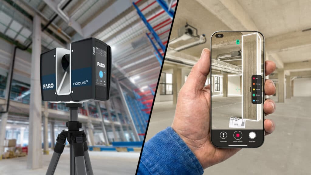
Three capture methods sit behind these platforms. 360° cameras record what a site looked like on a given date. Phone and tablet LiDAR records room geometry at centimetre level, fast and without extra hardware. Terrestrial and mobile laser scanners record dense point clouds at millimetre level for tolerance checks and scan-to-BIM. Many teams combine two of them.
360° cameras (OpenSpace, Matterport, DocuSketch, iGUIDE)
Best for visual records: progress walks, condition documentation, virtual tours. Some cameras add a lidar sensor for measured floor plans (Matterport Pro3, iGUIDE PLANIX). A 360° photo alone is a visual record, not a measurement.
Phone and tablet LiDAR (Metaroom, Polycam, magicplan)
Best for fast room-level geometry: floor plans, areas, wall lengths, existing conditions before renovation. The device is already in the pocket. Results depend heavily on the app: a 2023 study in the journal Geomatics tested four apps on the same iPhone 13 Pro against a terrestrial laser scanner and found clear differences between apps, with quick floor plans named as a well-suited use.
Laser scanners (Leica BLK360, NavVis MLX and VLX)
Best for survey-grade point clouds: deviation analysis against BIM, MEP-dense spaces, large buildings, scan-to-BIM at high level of detail. Higher hardware cost and more processing time.
Best 3D scanning platforms for facility management
For facility management, choose by portfolio size and how often spaces change. Metaroom fits the daily work of facility teams: in-house staff scan rooms and floors with an iPhone or iPad Pro and get floor plans, area lists and location-tagged asset photos, with no dedicated hardware or scanning service. Matterport and NavVis IVION suit large portfolios that need a permanent, navigable digital twin. iGUIDE suits measured floor plans for smaller portfolios on a per-project basis.
Facility teams scan for three reasons: an up-to-date record of the building, asset locations (meters, valves, fire equipment), and measured plans for space planning and refurbishment. Most FM work is the second and third: many small surveys, done often, by the team that runs the building. That favours a tool the team already carries over a camera kit booked for a scan day.
Metaroom
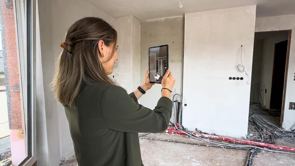
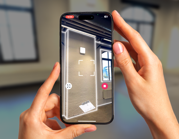
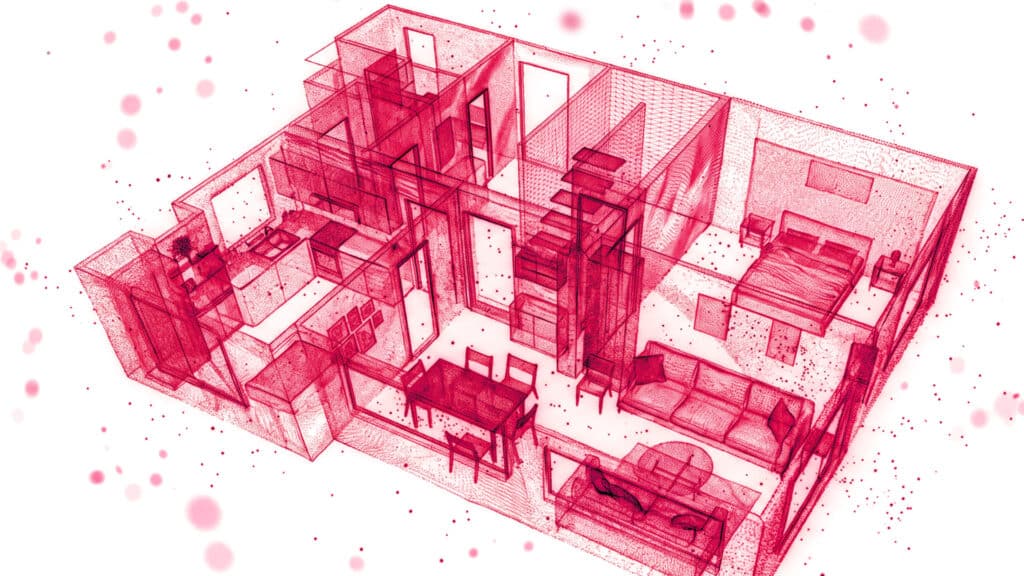
Metaroom is an iPhone and iPad LiDAR scanning app by Amrax with a browser-based Workspace. A room takes one to two minutes to scan. The Workspace generates the 2D floor plan automatically and exports PDF and DXF plans, Excel area and length lists for space planning, and IFC models for BIM and CAFM tools that import IFC. Snapshots tie photos to their exact position in the 3D model, so teams can mark radiators, switches, sockets, damage or maintenance needs and hand over a Snapshot export organised floor by floor. Matterport's own 2026 guide to FM documentation software lists Metaroom for mobile-first, room-level capture. Best for facility teams that survey often and want the results in their existing tools.
Matterport
Matterport is a 360° digital twin platform. A scan becomes a navigable model where teams tag assets, add notes and share access with contractors. E57 point clouds and BIM files are available as paid add-ons. Best when many people need to see the space remotely.
NavVis IVION
NavVis builds handheld and wearable laser scanners and IVION, web software that turns point clouds into a shared digital twin with asset tagging. Best for large, technical buildings and industrial sites where survey-grade data matters.
iGUIDE
iGUIDE is a camera system with built-in lidar that produces a 3D tour and measured floor plans per project, without a subscription. Best for smaller portfolios that need plans more than a permanent twin.
Polycam
Polycam is a general 3D capture app for phones, tablets and drone imagery with a wide range of mesh and point cloud exports. Best for quick captures that go into 3D or CAD tools.
Watch out: A digital twin is only useful while it stays current. Plan who rescans after changes, and how often, before choosing the platform.
Best 3D scanning platforms for construction QA/QC, RFIs and BIM overlays
For construction QA/QC, the best setup is usually two tools. A 360° capture platform such as OpenSpace documents the whole site on every walk, overlays BIM on the images and feeds RFIs and punch items to Procore or Autodesk Construction Cloud. A laser scanner such as the Leica BLK360 or a NavVis device measures as-built conditions at millimetre level for deviation checks against the model. iPhone LiDAR apps fit renovation as-builts and quick checks, not tolerance-critical inspections.
Searches for "3D LiDAR cameras for construction" mix two different tools. A 360° camera answers "what was installed, where and when". A laser scanner answers "is it within tolerance". RFIs and punch lists mostly need the first. Deviation analysis against BIM needs the second.
OpenSpace
OpenSpace is a construction reality capture platform. A 360° camera on a hard hat records a site walk, and the images are pinned to the floor plan by date. With BIM+ and BIM Compare, teams overlay model elements on 360° images, mark up differences and export BCF files to coordination tools. Best for recurring site documentation, RFIs and QA/QC by visual check.
Leica BLK360
The Leica BLK360 is a tripod-mounted imaging laser scanner. It captures 680,000 points per second and exports E57, RCP and LGS point clouds for Cyclone, Revit and other scan-to-BIM tools. Best for as-built verification and deviation analysis where millimetres matter.
Metaroom and Polycam
Phone LiDAR apps document existing conditions before renovation and produce DXF or IFC files for CAD and BIM. Accuracy is centimetre-level, so they fit planning, quantity checks and documentation, not tolerance checks.
NavVis MLX and VLX
NavVis handheld and wearable scanners capture large areas while walking. IVION adds construction verification and model validation against point clouds and panoramas. Best for large or MEP-dense projects where tripod scanning is too slow.
Watch out: Agree on the accuracy you need before choosing hardware. Visual QA, quantity checks and tolerance checks have very different requirements.
Best 3D scanning platforms for restoration and insurance claims
For water, fire and storm restoration, the deciding feature is the Xactimate ESX export. magicplan and DocuSketch both export ESX files and add restoration workflows such as moisture mapping, drying logs or on-site estimates. iGUIDE also exports ESX from its camera scans. General scanning apps document the space well but usually need a separate step to reach the estimate.
Restoration documentation has to stand up to an adjuster. That means a measured floor plan, photos tied to rooms, moisture readings over time, and a scope that opens in the estimating software.
magicplan
magicplan is a floor plan and field documentation app for iOS and Android. Its water mitigation workflow logs moisture readings on the floor plan, tracks drying across visits and exports the scope as an ESX file for Xactimate. Best for mitigation companies that want one app on site.
DocuSketch
DocuSketch is a 360° documentation platform for restoration contractors and insurance carriers. Its 360AI engine, launched in 2026, generates floor plans, scope items and Xactimate-compatible ESX estimates from 360° capture. Best for teams that already document with 360° cameras.
Metaroom
Metaroom produces floor plans and a Snapshot photo export that places each damage photo on the plan, which helps with insurance documentation. It has no Xactimate ESX export, so it fits pre-loss documentation and renovation planning better than claims estimating.
iGUIDE
iGUIDE exports ESX and DWG files alongside its 3D tour and floor plans. Best for contractors and adjusters who want a camera-based record of the whole property.
Watch out: Check that the ESX export includes walls, openings and room names, not only the outline. A partial sketch still means rework in Xactimate.
Best 3D scanning platforms for real estate
For real estate marketing, Matterport and iGUIDE are the standard choices because they combine an immersive 3D tour with measured floor plans. iGUIDE floor plans follow the ANSI Z765-2021 measuring standard. When an agent or appraiser needs floor plans and areas without a tour, phone LiDAR apps such as Metaroom, magicplan or Polycam produce them with a device already in hand.
Buyers look at tours. Contracts, valuations and listings rely on floor plans and area figures. Decide which of the two the listing actually needs.
Matterport
Matterport is one of the most widely used 3D tour platforms in real estate. The Pro3 camera starts at $3,995, and hosting runs on a subscription. Best for listings where the tour drives enquiries.
Metaroom
Metaroom exports 2D floor plans as PDF or DXF, including a simplified PDF floor plan with minimal colours. That simplified layout is fixed and cannot be customised. Best for floor plans and area documentation without a tour.
iGUIDE
iGUIDE combines a 3D tour with floor plans measured by a built-in lidar sensor, charged per project with no subscription. Best for agents and photographers who need standard-compliant area figures.
magicplan and Polycam
Both create floor plans on a phone. magicplan focuses on plans and reports. Polycam adds 3D models and photogrammetry. Best for occasional listings and quick plans.
Watch out: Area figures in listings often fall under local rules (ANSI Z765 in the US, Wohnflächenverordnung in Germany). A scanner measures; the calculation method still has to match the standard.
Best 3D scanning platforms for energy consulting
For energy consulting, the scan has to produce room areas, wall and window dimensions and volumes in a format the energy software reads. iPhone LiDAR apps fit best because energy audits rarely need millimetre data. Metaroom exports IFC directly to CASCADOS and Excel area lists for energy assessments in Germany and Austria. magicplan feeds Heat Engineer for room-by-room heat-loss calculations to EN 12831 in the UK.
Energy consultants lose most time on the building survey, not the calculation. Missing plans in existing buildings mean measuring every room by hand before modelling starts.
Metaroom
Metaroom scans rooms and floors with an iPhone or iPad Pro, generates the 2D floor plan automatically and exports IFC for CASCADOS as well as Excel quantities for areas and lengths. Snapshots mark radiators, windows and insulation details in the model. Best for energy consultants who need a usable plan of an existing building on the first visit.
magicplan
magicplan creates floor plans on site and passes the plan data to Heat Engineer, a UK heat-loss and heating design platform working to EN 12831-1, MCS and CIBSE. Best for heating engineers and heat-pump installers in the UK.
Polycam
Polycam captures 3D geometry and exports DXF and point clouds. Best when the energy model is built in a CAD or BIM tool.
Laser scanners
Leica and NavVis scanners deliver more precision than most energy audits need. They make sense for large non-residential buildings where the point cloud also serves other trades.
Watch out: Thermal imaging and blower-door tests stay separate tools. 3D scanning replaces the tape measure, not the energy diagnosis.
How to choose: four questions
- What decision will the scan support? A record of the site, a measured plan or a tolerance check. Each points to a different capture method.
- Which file does the next tool need? ESX for Xactimate, IFC for BIM and energy software, DXF or DWG for CAD, E57 for point cloud tools. Start from the target software and work backwards.
- Who scans, and how often? Weekly site walks by field staff favour 360° cameras or phones. Occasional surveys by specialists can justify a laser scanner.
- What does the total cost look like over a year? Count hardware, subscriptions, per-project fees, export add-ons and the hours spent capturing and processing.
Related reading
Frequently Asked Questions
What is the best 3D scanner for construction QA/QC?
For visual QA/QC (Quality Assurance and Quality Control), RFIs and punch lists, a 360° capture platform such as OpenSpace is a common choice because it documents every site walk and overlays BIM on the images. For tolerance checks and deviation analysis against the model, a laser scanner such as the Leica BLK360 or a NavVis device is needed. Many general contractors use both.
What is the difference between a 360° camera and a LiDAR scanner?
A 360° camera records images of the whole space and is used for visual documentation and virtual tours. A LiDAR scanner measures distances and records geometry as a point cloud or mesh. Some devices, such as the Matterport Pro3 and iGUIDE PLANIX, combine both.
Is iPhone LiDAR accurate enough for professional building documentation?
For floor plans, room areas, renovation planning and energy audits, yes. iPhone and iPad Pro LiDAR apps deliver centimetre-level results; Metaroom states up to 99% accuracy. Research published in Geomatics in 2023 found that results vary between apps on the same device. For tolerance checks in construction, use a laser scanner.
Which 3D scanning tools export to Xactimate?
magicplan, DocuSketch and iGUIDE export ESX files that open in Xactimate. Matterport data can reach Xactimate through third-party services. Most general 3D scanning apps do not export ESX.
What is the best 3D scanning platform for facility management?
For recurring surveys by in-house teams, Metaroom produces floor plans, area lists, IFC models and location-tagged asset photos from an iPhone or iPad Pro, without dedicated hardware. For large portfolios that need a permanent digital twin, Matterport and NavVis IVION are widely used. iGUIDE suits per-project floor plans for smaller portfolios.
Can Metaroom be used for facility management?
Yes. Facility teams use Metaroom to scan rooms and floors with an iPhone or iPad Pro, generate 2D floor plans and Excel area lists for space planning, export IFC models for BIM and CAFM tools, and document assets and maintenance needs with Snapshots placed in the 3D model. It does not replace a building-wide digital twin with live tours.
Do I need a Matterport camera for real estate floor plans?
No. A Matterport camera is mainly for 3D tours. For floor plans and area figures alone, iGUIDE or phone LiDAR apps such as Metaroom, magicplan and Polycam produce measured plans. Check that the area calculation follows the local measuring standard.
Which 3D scanning app works with energy consulting software?
Metaroom exports IFC to CASCADOS and Excel area lists, which suits energy consultants in Germany and Austria. magicplan connects to Heat Engineer for heat-loss calculations in the UK. Both run on a phone or tablet, so no extra hardware is needed.
Try phone-based scanning on your next survey
Metaroom turns an iPhone or iPad Pro scan into a 2D floor plan, Excel quantities and IFC export. The app is free. Workspace plans start at €149 per year, with a 30-day free trial.